An Island You Have to Mean to Find
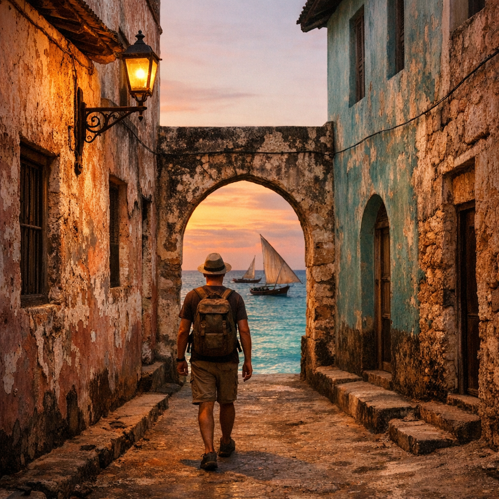
There is no direct flight to the Island of Mozambique. You fly into Nampula, the provincial capital on the mainland, and then you drive nearly three hours east toward the coast, watching the landscape shift from red dirt roads and cashew groves to mangrove flats and, finally, the sea. And then, almost without warning, a low bridge appears — barely three kilometers long, built in the 1960s to finally connect the island to the continent it had faced for four hundred years without ever quite touching it. You cross the bridge, and the temperature of the light changes. Coral-stone buildings the color of old bone and faded ochre rise up on both sides. Fishermen mend nets in doorways. A mosque’s call to prayer drifts over a Catholic cathedral’s bell tower. This is Ilha de Moçambique — the Island of Mozambique — a spit of land roughly three kilometers long and five hundred meters wide, holding, in that small footprint, one of the most consequential and least-known chapters of African and world history.
Most Black American travelers who make the trip to East Africa go looking for the safari circuit — Kenya, Tanzania, the Serengeti, Zanzibar’s Stone Town. Mozambique rarely makes that list, and when it does, it’s usually for the beach resorts of the south, near Maputo, or the dive sites of the Bazaruto Archipelago. Almost no one comes looking for Nampula Province, and almost no one has heard of this particular island — despite the fact that it gave an entire nation its name. Vasco da Gama anchored offshore in 1498 during his first voyage to India, and Portuguese sailors adopted a version of the name of the local ruler they encountered there, Sultan Ali Musa Mbiki (rendered by the Portuguese as “Moçambique”). Within a decade, Portugal had built a fort on the island and made it the seat of colonial power over the entire eastern African coast. That name eventually stretched to cover a territory over 300,000 square miles larger than the island itself — the whole of modern Mozambique carries the name of this one small place.
Four Hundred Years as the Capital of an Empire
From roughly 1507 until 1898, the Island of Mozambique served as the capital of Portuguese East Africa — nearly four centuries during which a coral outcropping smaller than many city parks functioned as the administrative, military, religious, and commercial center of Portugal’s entire Indian Ocean colonial project. That is longer than the United States has existed as a country, governed from a single small island most Americans could not locate on a map.
The reason the Portuguese Crown valued it so highly had nothing to do with the island itself, which has no fresh water source of its own and had to import drinking water from the mainland by boat for most of its history. What the island offered was position: it sat directly on the maritime corridor connecting Lisbon to Goa, the jewel of Portugal’s colonial holdings in India. Ships making the grueling voyage around the Cape of Good Hope needed a fortified, resupplied stop before continuing north across the Indian Ocean, and the island — already an established node in the older Swahili-Arab trading network that had linked the East African coast to Persia, India, and Arabia for centuries before the Portuguese ever arrived — was a natural choke point to seize and hold.
Once in Portuguese hands, the island became a hub for the trade that generated its wealth: ivory, gold funneled down from the interior through Sofala and the Zambezi valley, spices moving along the Indian Ocean routes, and — devastatingly — enslaved people. The Indian Ocean slave trade out of this stretch of the East African coast predates the Portuguese arrival, run for centuries by Swahili and Arab merchants supplying markets in the Middle East, Persia, and India. The Portuguese folded themselves into and then expanded this existing system, using the island’s fortified harbor to hold and ship captive East Africans — bound not primarily for the Americas, as with the transatlantic trade most familiar to American audiences, but northeast across the Indian Ocean and, from the eighteenth century onward, increasingly toward French plantation colonies in the Mascarene Islands (Mauritius and Réunion) as well. Later, in the nineteenth century, even as European powers began outlawing the transatlantic trade, the island continued to function within a slave-trading economy that persisted in East Africa for decades after abolition elsewhere, some of it illicit, some of it thinly disguised as “labor contracts.” This is not a footnote to the island’s history — it is one of the central reasons the fort, the harbor, and the warehouses were built the way they were, and it deserves to be named plainly rather than folded into vaguer language about “trade.”
Stone Town and Macuti Town: A Border You Can Still Feel
Walk the length of the island today and you walk through a colonial hierarchy that was never subtle and has never fully disappeared. The northern half is Stone Town (Cidade de Pedra) — the administrative and commercial core, built from coral limestone and lime mortar in a dense grid of two- and three-story buildings, churches, the old customs house, and government offices, styled with Portuguese, Arab, Indian, and Swahili architectural influences layered on top of one another over centuries. This was the district reserved for Portuguese colonists, wealthy traders, and the colonial administration. It is the part of the island UNESCO highlights most often in photographs, and it is genuinely beautiful — narrow lanes barely wide enough for two people to pass, wooden balconies, faded pastel plaster, wrought-iron details imported from Goa and Lisbon alike.
The southern half is Macuti Town (Cidade de Macuti), named for the palm-thatch roofing — macuti — that distinguishes its architecture. This is where the African and mixed-race population of the island was historically confined, in simpler reed-and-thatch housing without the stone construction, plumbing, or formal urban planning granted to Stone Town. It is also, today, where the overwhelming majority of the island’s roughly 14,000 residents actually live. The physical line between the two districts was never accidental — it was colonial urban planning functioning exactly as designed, sorting people by race and class into structurally different qualities of housing, sanitation, and civic investment. That line is still walkable today. You can stand at the seam between Stone Town’s coral façades and Macuti Town’s more modest, densely packed streets and feel, immediately, that you have crossed from one designed reality into another. UNESCO’s own inscription of the island in 1991 as a World Heritage Site cites exactly this: the site was recognized for its remarkable and continuous fusion of African, Arab, Persian, Indian, and European building traditions and, implicitly, for the urban record that fusion left behind — including the record of its inequities.
What to See
Fort São Sebastião — Construction began in 1558 and continued for decades, making this one of the oldest surviving European fortifications anywhere in sub-Saharan Africa. Built from massive blocks of quarried stone at the island’s northern tip, the fort was designed to withstand both naval assault and siege, and it succeeded — it repelled Dutch attacks in the early seventeenth century and remained in continuous Portuguese use for hundreds of years. Inside its walls sits the Chapel of Nossa Senhora de Baluarte, built around 1522, which is frequently cited as the oldest European building still standing in the entire Southern Hemisphere. Walking the fort’s ramparts, looking out over the channel that ships from Lisbon, Goa, and points between all had to pass, is the clearest single vantage point for understanding why this speck of land mattered so much for so long.
Stone Town’s core — The Palace and Chapel of São Paulo, once the residence of Portuguese governors and now home to a museum of decorative arts, gives a sense of the wealth that moved through the island at its height. The Hospital de Ilha de Moçambique, an imposing colonial-era building, and the old Governor’s Palace are worth walking past even if not every building is open to visitors. Much of the value of Stone Town, though, is simply in walking its lanes slowly — noting the Indian-style verandas, the Swahili-style carved doors, the Arab-influenced window screens, all coexisting on buildings that are, in many cases, structurally crumbling and in real need of preservation investment.
Macuti Town and the local markets — Spend real time on the southern half of the island, not just Stone Town. The fish market near the old jetty, where the day’s catch comes in on small boats, gives a far more accurate sense of daily life on the island than the fort does. This is also where most of the island’s guesthouses, small restaurants, and artisans are based, and where tourism dollars spent directly with residents make the most difference.
The mainland crossing itself — The bridge connecting the island to Lumbo on the mainland is unremarkable to look at but worth pausing on: for nearly four hundred years, everything and everyone that reached this capital came by boat, and the total isolation that made the island so easy to fortify and control is something you feel most acutely on that short crossing.
Getting There and Staying Safe
Getting to the Island of Mozambique realistically means flying into Nampula International Airport, either via Maputo or via a connection through Johannesburg, and then arranging a car or shared transfer for the roughly three-hour drive to the island. Independent overland travel through northern Mozambique from other directions is not advisable given the region’s infrastructure and security situation, and most visitors fly.
On safety: it is worth being precise here, because the northern Mozambique headlines of the past several years are genuinely serious and deserve to be taken at face value — but they do not describe the island itself. As of 2026, the U.S. State Department rates Mozambique overall at Level 2, “Exercise Increased Caution” (the advisory was downgraded from Level 3 in mid-2025). Within that overall rating, the advisory carves out specific Level 4, “Do Not Travel” zones tied to an active insurgency: all of Cabo Delgado Province, the Niassa Special Reserve, and specific northern districts of Nampula Province — Memba and Erati — where terrorist attacks on villages, government forces, and supply routes have continued. Those are real, current, and should be taken seriously; this is not a place to freelance an itinerary around.
The Island of Mozambique sits within its own separate district, Ilha de Moçambique District, well south of the flagged Cabo Delgado insurgency and outside the specific Nampula districts named in the Level 4 advisory. It falls under the general Level 2 guidance that applies to most of the country — meaning standard precautions around opportunistic crime, avoiding travel after dark, and staying alert in crowds, rather than the conflict-zone guidance that applies further north. That said, advisories change, and northern Mozambique’s security situation has shifted before; anyone planning this trip should check travel.state.gov directly before booking and again before departure, and should register with the U.S. Embassy’s STEP program. Travel with a reputable local operator or guesthouse that has current, on-the-ground knowledge of conditions, and treat any official guidance you receive locally as more current than anything written here.
Practical Notes
Portuguese is the official language, though Emakhuwa is the dominant local language on the island and in Nampula Province generally; a few words of Portuguese go further than English does. The island has a limited number of small guesthouses and pousadas, many in restored Stone Town buildings, and options are far more limited than at a typical resort destination — book ahead. Electricity and water can be inconsistent, a direct legacy of the island’s centuries-long dependence on imported resources. Bring cash; card infrastructure is thin. The best months weather-wise are the dry season, roughly May through October, avoiding the cyclone season that affects this stretch of coast between January and March.
Why This Island Deserves to Be Known
It is easy to treat a place like this as merely picturesque — a UNESCO stamp, some pastel walls, a fort for the photographs. But the Island of Mozambique is not a ruin and not a museum piece; roughly 14,000 people live there now, in Macuti Town more than Stone Town, going about ordinary life in a place that happens to carry an extraordinary weight of history. For four hundred years, decisions made on this tiny island shaped the fate of an entire eastern African coastline and the people who were traded across it. The line between Stone Town and Macuti Town is still there because the people who live in Macuti Town are still there, still building lives in the same physical geography their ancestors were assigned centuries ago.
For Black travelers looking past the well-worn safari-and-savanna image of East Africa, this island offers something the circuit rarely does: a direct, walkable, physically intact record of how the Indian Ocean world — African, Arab, Indian, Persian, and European — was built, traded, stratified, and, eventually, remade. It asks to be visited not as an exotic curiosity but as what it is: a real place, with a real and living population, that happened to sit at the center of an empire for longer than most empires last at all.